Tibet 200529 May - 18 June 2005 |
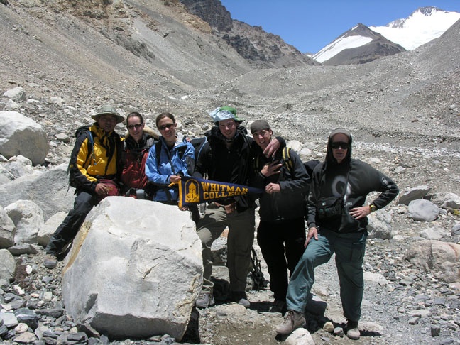
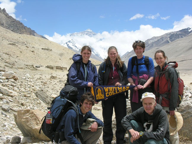
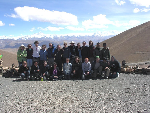
*Click on Pictures to Enlarge an ImageParticipants: Sammie Arthur '07 Biology - Environmental Studies; Mary Ashby '05 Chemistry - Environmental Studies; Dan Berg '06 Geology - Environmental Studies; Beth Blum '06 English; Egan Brinkman '07 Sociology; Sam Caruthers-Knight '05 Geology - Environmental Studies; Jodie Gates '07 Sociology - Environmental Studies; Meghan Goss '06 Religion; Miles Johnson '07 Biology - Environmental Studies; Taylor Johnson '07 Geology; Tyler Kohlhoff '07 Studio Art; Erin McMahan '06 Politics - Environmental Studies; Brittany Peterson '06 Chemistry; Zoe Plakias '08 undeclared; Oak Rankin '05 Politics - Environmental Studies; Amy Sharp '06 Art History; Laurel Stratton '07 Geology; Meg Tuttle '05 Geology - Environmental Studies; Clare Carson Director of Academic Resources; Bob Carson Professor of Geology and Environmental Studies Guides:
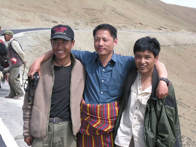
Palden (from Bhutan); Lhada (from Lhasa); Tshewang (from Lhasa) |
|
Whitman Rocks Tibet by Bob CarsonJune 1: Arrival on the Roof of the World (Chengdu-Lhasa) Having
left Walla Walla on Saturday, 28 May, Clare and I finally landed in
Tibet at the Gongkar airport between the capital Lhasa and the third
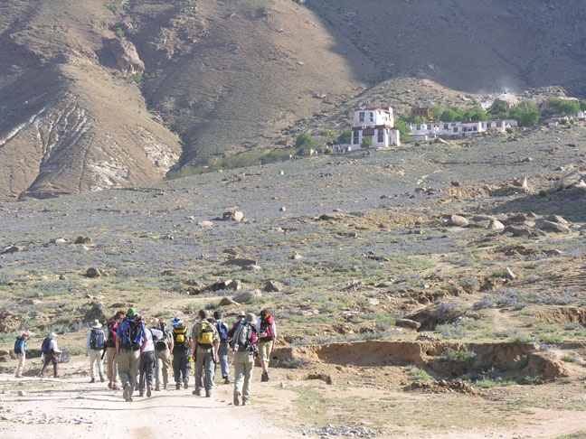
largest city, Tsetang. With us are 18 Whitman students (4 now alums),
12 women and 6 men, of 9 different majors. We hooked up with them in
Seattle, Nerita (near Tokyo, Japan), and Bangkok. Each of the 4 flights
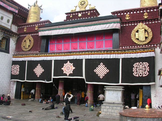
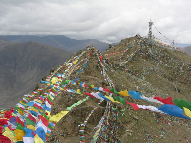
was, fortunately, shorter than the previous one. June 2: Lhasa II (Jokhang and Sera)
June 3 : Lhasa III (Pabonka)
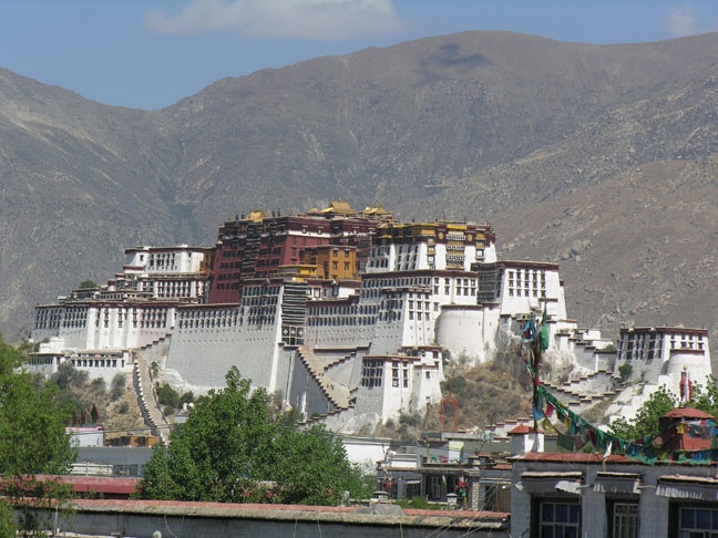
June 4: Lhasa IV (Potala and Dungkar)
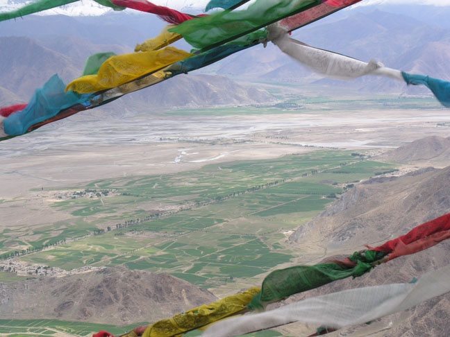
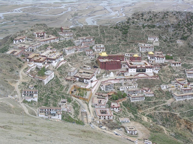
June 5: Lhasa - Ganden
June
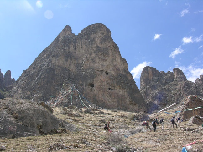
6 : Lhasa - Shigatse (via Shogu La and Dongu La) June 7: Shigatse - Gyantse Plate tectonics was the theme of our long morning roundtrip drive between Shigatse and Gyantse. At Shigatse the clastic sedimentary rocks were marine sediments deposited on the south edge of the passive margin of Eurasia. In contrast, at Gyantse similar sediments were deposited on the north edge of the active margin of India. Between the two continents was the Tethys Sea, underlain by oceanic crust. As the two continents collided, a piece of oceanic crust was caught in the vice. We stopped at three places to sample the oceanic crust (pillow basalts and red chert at the top, with sheeted dikes beneath) and upper mantle (serpentinite). The
claim to fame in the Pelkor Chode Monastery in Gyantse is the Gyantse
Kumdum, Tibet's largest stupa (35 m high). We got good views of the stupa
from the highest point within the monastery, sitting on a hillside and
surrounded by a wall. In the distance we saw another fortress-like monastery.
Bhutan lies to the south of Gyantse; British troops came here in 1904,
on their way to Lhasa. The
claim to fame in the Pelkor Chode Monastery in Gyantse is the Gyantse
Kumdum, Tibet's largest stupa (35 m high). We got good views of the stupa
from the highest point within the monastery, sitting on a hillside and
surrounded by a wall. In the distance we saw another fortress-like monastery.
Bhutan lies to the south of Gyantse; British troops came here in 1904,
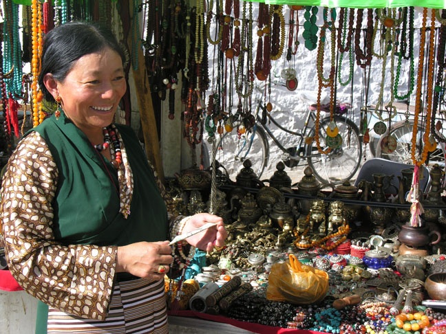
on their way to Lhasa. 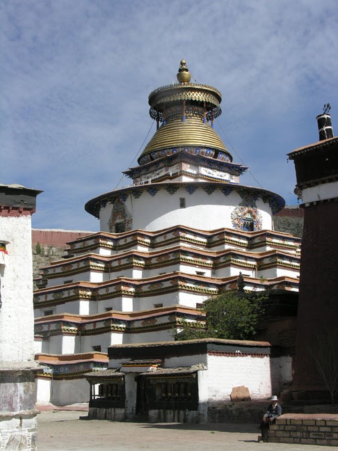 After a late lunch we explored the Tashilhunpo Monastery, founded in 1447. The remains of the first Dalai Lama are here. The monastery includes a 90-year-old (hollow) copper statue. The tombs of many Panchen Lamas (second only to Dalai Lamas) are within the monastery. Shigatse is the second largest city in Tibet. The Shigatse market outdoes the Lhasa Tibetan business area in terms of the passion of the sales persons, mostly women in traditional clothes. We walked through the stands of jewelry, gift items, etc. Nearby were foods, and cloth. Men played pool and craps. Generally one can get about half of what they ask, sometimes one third 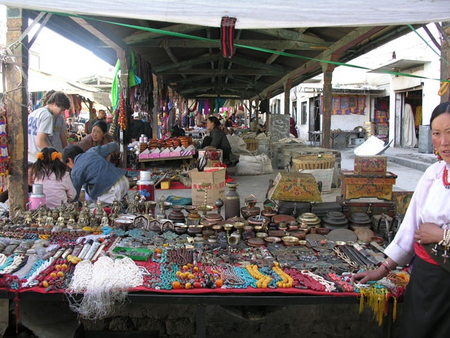 if
you are persistent and/or walk away. At one time I had five women tugging
at me trying to get me to buy their wares. Some, including Clare, almost
had to wrestle themselves away from aggressive salespersons. You hear
many phrases like cheap, how much, lowest, final, me poor, and
look repeatedly. I love the bargaining. if
you are persistent and/or walk away. At one time I had five women tugging
at me trying to get me to buy their wares. Some, including Clare, almost
had to wrestle themselves away from aggressive salespersons. You hear
many phrases like cheap, how much, lowest, final, me poor, and
look repeatedly. I love the bargaining. The food here is very similar at breakfast, lunch, and dinner: jasmine tea, water or coke or sprite, mixtures of meat and vegetables, rice, noodles, soup, tofu. There is no salad, and little if any bread. Dessert is apple wedges. The hotel employees are all very friendly. June 8 : Shigatse - Sakya 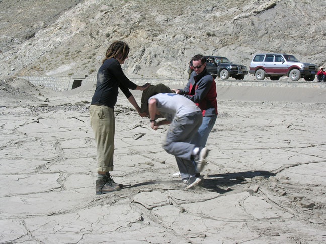
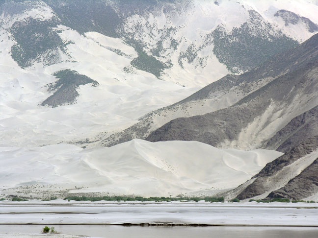
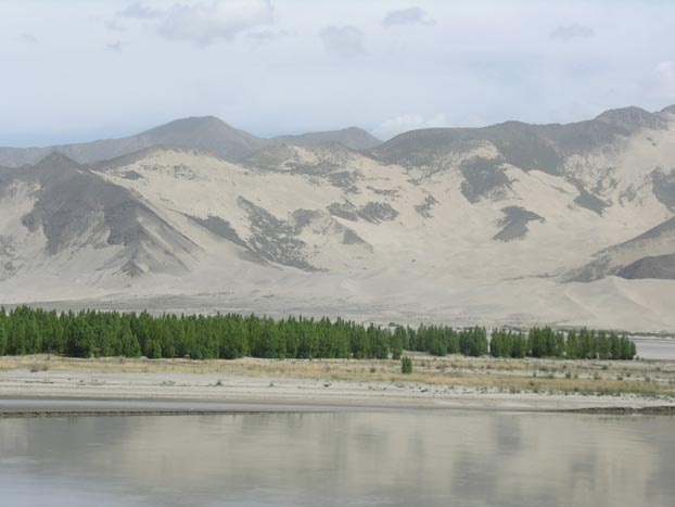
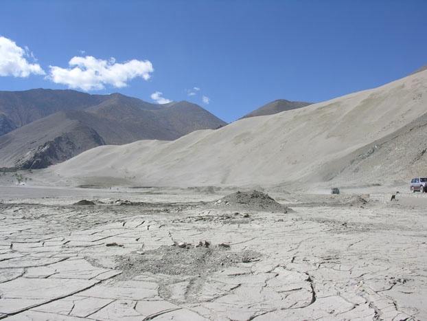 Today we crossed the Yarlung Tsangpo and drove east (upvalley) along
the north shore. There are many dunes along the river.
Today we crossed the Yarlung Tsangpo and drove east (upvalley) along
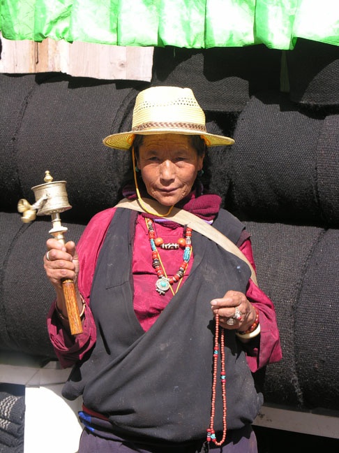
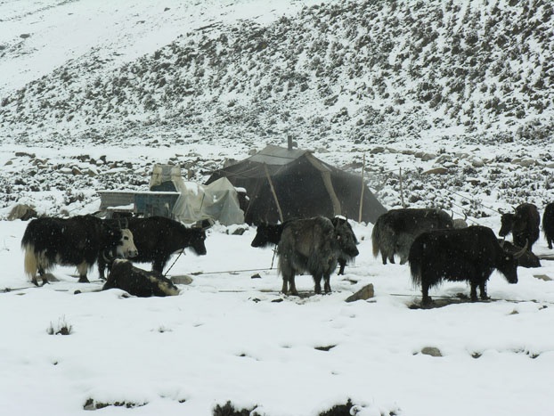
the north shore. There are many dunes along the river. Today and two days ago and at Ganden Monastery we had a picnic lunch outside. Nomads, as Palden calls them, appear and watch you eat, knowing that they will get the leftovers, which are considerable. They take not only the food, but the trash. They love the 1.5-liter water bottles. 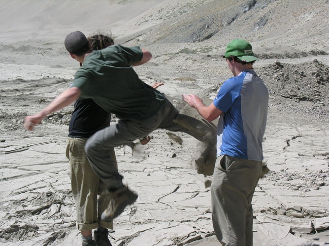 They bring us a water bucket or some other container for our leftover
rice. The cardboard and paper is good for starting fires. Two days ago
they brought baby goats to show us. In general they do not want their
pictures taken; but if they do, they enjoy seeing the digital photos
on the screen.
They bring us a water bucket or some other container for our leftover
rice. The cardboard and paper is good for starting fires. Two days ago
they brought baby goats to show us. In general they do not want their
pictures taken; but if they do, they enjoy seeing the digital photos
on the screen. After lunch we continued through road construction and finally a paved road to Shigatse, the capital of Tibet from 1268 to 1354. During this time Tibetan Buddhism spread to Mongolia, and the Monguls spared Tibet. 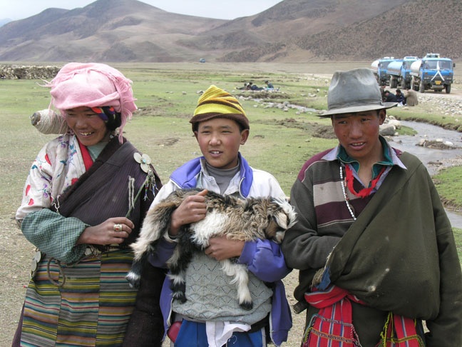 There are a few peaks to the south with a snow caps, and as we left
the Yarlung - Tsangpo we saw many more, perhaps even one glacier. All
the hills and mountains are very dry, with next to no vegetation. This
contrasts sharply with the green flood plains, with many fields, often
with a rock in the center. We also saw lots of cottonwood afforestation
of the flood plain.
There are a few peaks to the south with a snow caps, and as we left
the Yarlung - Tsangpo we saw many more, perhaps even one glacier. All
the hills and mountains are very dry, with next to no vegetation. This
contrasts sharply with the green flood plains, with many fields, often
with a rock in the center. We also saw lots of cottonwood afforestation
of the flood plain. 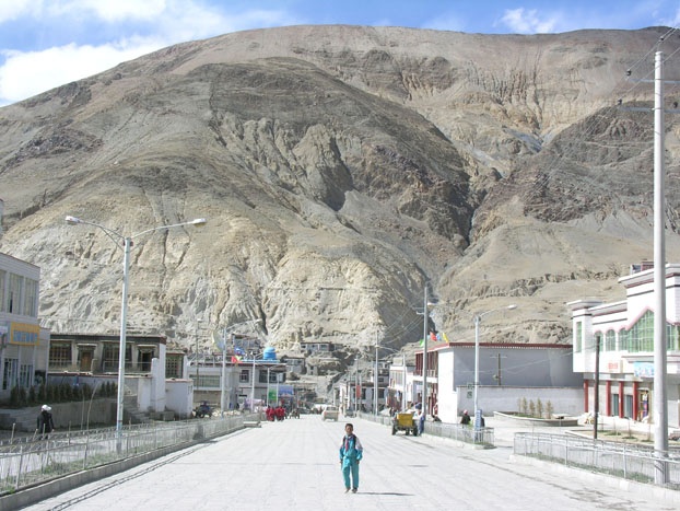 Sakya is small, and mostly modern and Chinese, except for the monastery near out hotel. There's another monastery with stupas across the valley to the north. The one we explored is notable for support pillars 1m in diameter, juniper trees brought 600 km from southeastern Tibet. 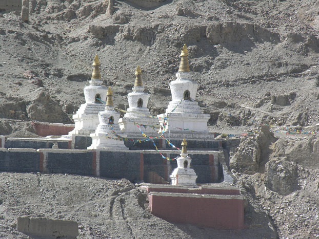 June 9 : Sakya - Rongbuk (via Dong La and Pang La) 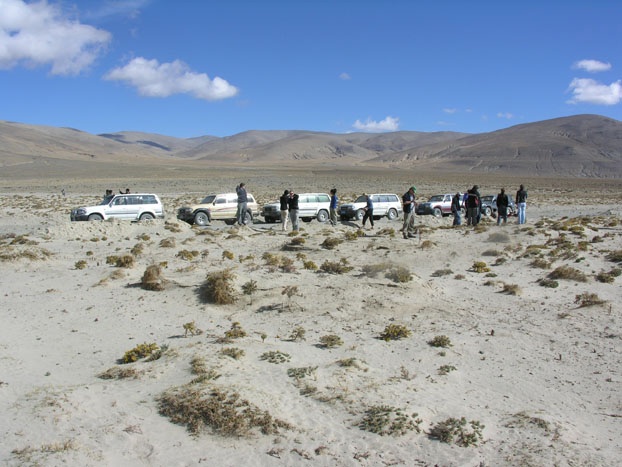 Today was a really tough day in the vehicles: long, bouncy, dusty, warm.
We took a route the guides had never been
Today was a really tough day in the vehicles: long, bouncy, dusty, warm.
We took a route the guides had never been 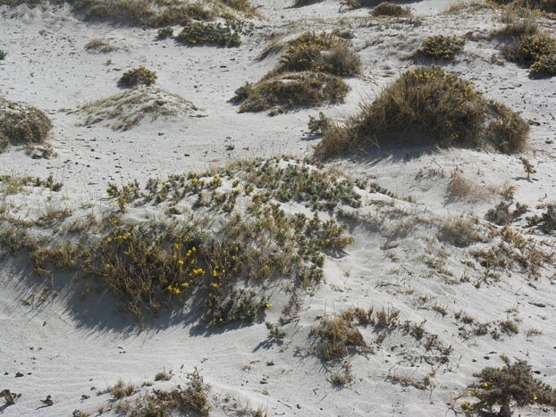 before.
Often the vehicles needed 4WD for loose sand. We splashed across some
streams. We encountered our first bothersome tiny insects (by the millions)
at an intended lunch stop by a river, but moved west. before.
Often the vehicles needed 4WD for loose sand. We splashed across some
streams. We encountered our first bothersome tiny insects (by the millions)
at an intended lunch stop by a river, but moved west. The geology was spectacular: intensely folded clastic sedimentary rocks, plus a little limestone and gneiss. These hillsides are unraveling, and have giant alluvial fans at their bases. We drove through tens of kilometers of coppice dunes with yellow gorse-like 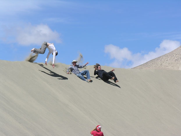 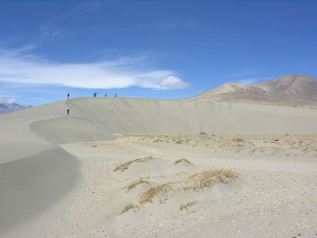 shrubs/flowers anchoring them. And we played on textbook barchans. From
two passes we had great views of the high Himalayas. All the villages
have red and black stripes on gray walls. The weather continues to be
beautiful.
shrubs/flowers anchoring them. And we played on textbook barchans. From
two passes we had great views of the high Himalayas. All the villages
have red and black stripes on gray walls. The weather continues to be
beautiful. This afternoon we entered Qomolangma National Nature Preserve (e.g., Mt. Everest national park). From the entrance one drives over Pang La (a pass about 17,000' high) for a spectacular view of high Himalaya peaks. Near Posum we traded our Toyota Land Cruisers for official tourist vans and drove upvalley, the views of Mt. Everest and nearby snowy peaks getting better and better. 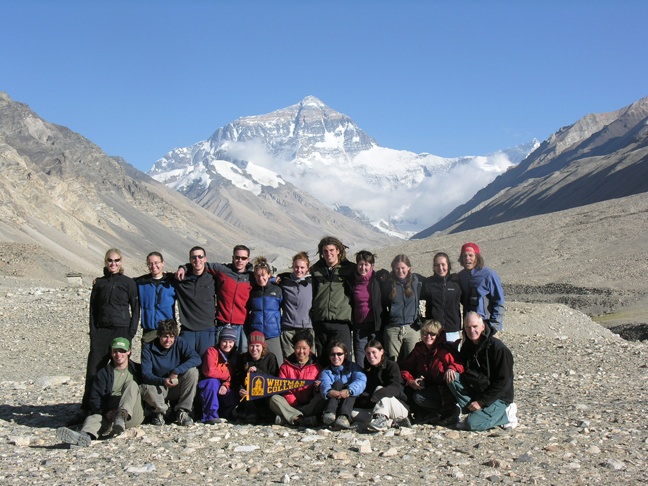
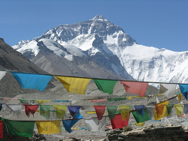
 I
took pictures of the north side of Mt. Everest, and nearby lateral moraines,
before coming into the hotel in the Rongbuk Valley. I lie on my bed looking
at the north face of Mt. Everest, with clear blue sky rising above the
29,000' peak (only 13,000' above us). I
took pictures of the north side of Mt. Everest, and nearby lateral moraines,
before coming into the hotel in the Rongbuk Valley. I lie on my bed looking
at the north face of Mt. Everest, with clear blue sky rising above the
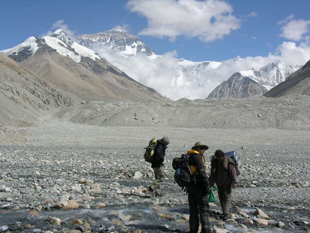
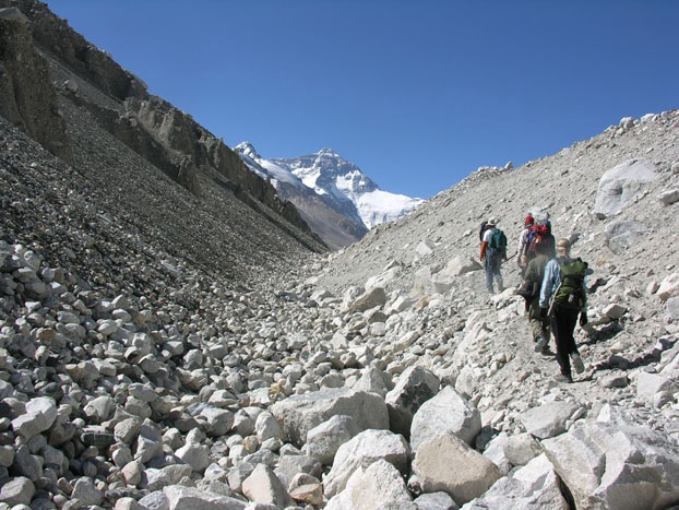
29,000' peak (only 13,000' above us). June 10 : Everest I (Base Camp) 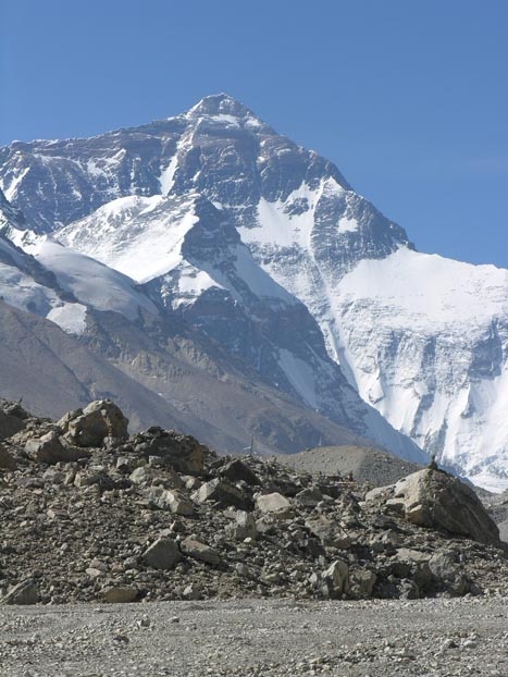 Today
we hiked to two caves, one very holy, about 5 km upvalley from the hotel.
The caves are in a huge rockfall with giant boulders of gneiss and migmatite.
We saw slicklenlines, garnets, and tourmalines. Most returned to the hotel
for a late lunch, but four of us hiked to Everest Base Camp at 16,900'
(another 3.5 km upvalley). There we had a light lunch in one of many tents,
and checked out tomorrow's route. In the afternoon there is a very Today
we hiked to two caves, one very holy, about 5 km upvalley from the hotel.
The caves are in a huge rockfall with giant boulders of gneiss and migmatite.
We saw slicklenlines, garnets, and tourmalines. Most returned to the hotel
for a late lunch, but four of us hiked to Everest Base Camp at 16,900'
(another 3.5 km upvalley). There we had a light lunch in one of many tents,
and checked out tomorrow's route. In the afternoon there is a very 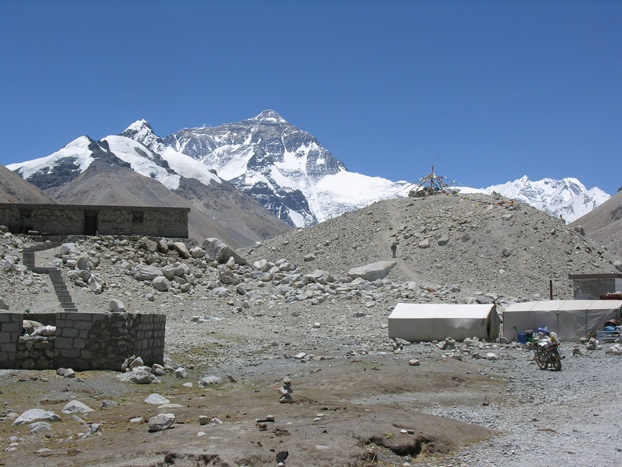 strong
downvalley katabatic wind off the glaciers. After viewing Everest and
Nuptse, we hiked back to the hotel. strong
downvalley katabatic wind off the glaciers. After viewing Everest and
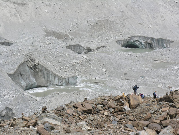
Nuptse, we hiked back to the hotel. What good fortune to have had clear weather all day. The sun hits Everest from 7am to 9pm, the light on the cliffs and snowfields changing all day. This valley has textbook glacial geology, with four terminal moraine complexes from just above Base Camp (below stagnant ice of the Rongbule Glacier) to below the hotel. 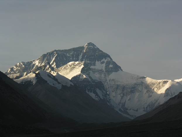 The
steep valley sides are mostly covered with colluvium - there is till and
gneiss in places. The beauty leaves no doubt as to why this was the second
holiest place in Tibet (after Mt. Kalish at the headwaters of Yarlung
Tsangpo). The
steep valley sides are mostly covered with colluvium - there is till and
gneiss in places. The beauty leaves no doubt as to why this was the second
holiest place in Tibet (after Mt. Kalish at the headwaters of Yarlung
Tsangpo). June 11 : Everest II (Camp I)
June 12: Everest III (Rongbuk - Posum) 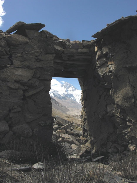 This
morning Oak and I climbed to the highest of the nunneries/monasteries
that existed before the Cultural Revolution. The Chinese destroyed them
(and paid Tibetan youth to do the same). We found lots of broken pottery.
Meanwhile, five women hiked south toward the rockfall to boulder with
their rock-climbing shoes. This
morning Oak and I climbed to the highest of the nunneries/monasteries
that existed before the Cultural Revolution. The Chinese destroyed them
(and paid Tibetan youth to do the same). We found lots of broken pottery.
Meanwhile, five women hiked south toward the rockfall to boulder with
their rock-climbing shoes. In the afternoon seven of us (mostly geology majors) hiked north along the road past two moraine complexes, trying to figure out the glacial history of the Rongbuk Valley. About 2-3 km north of the hotel, the vans, which held everyone else, picked us up for the drive to Posum. We knew in advance that the hotel in Posum would be sketchy. There is a ladder to the upstairs bunkrooms (holding three to ten each) and pit toilet. We liked it until the night. On top of our coughs, earaches, congestion, etc., an intruder came into the rooms twice, a dog barked all night, and smoke rose from the bar/restaurant below. Many got little sleep. June 13: Posum - Shigatse (via Pang La and Gatso La) Today was a long day of driving including two passes about 17,000' high. The first, Pang La, we had been over before, but today the high Himalayas were mostly in the clouds. On both sides of Pang La there are dozens and dozens of switchbacks on this relatively new and good highway.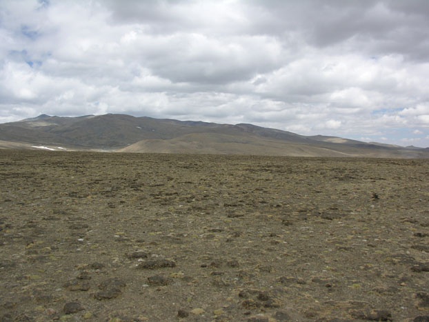 The northern pass, Maphu La, has gradual ascents from both directions.
All around is tundra, with no mountains in sight. A few small snow patches
decorated the rather barren landscape. The northern pass, Maphu La, has gradual ascents from both directions.
All around is tundra, with no mountains in sight. A few small snow patches
decorated the rather barren landscape. We had lunch at a Chinese restaurant in Chusar/Lhatso. Then we retraced our route of more than a week ago, going down the Yarlung Tsangpo, mostly on the north side of the river. The showers in the Shigatse hotel were quite welcome after almost a week near Mt. Everest. June 14: Shigatse - Lhasa (via Karola, Yamdrok Tso and Gampa La) 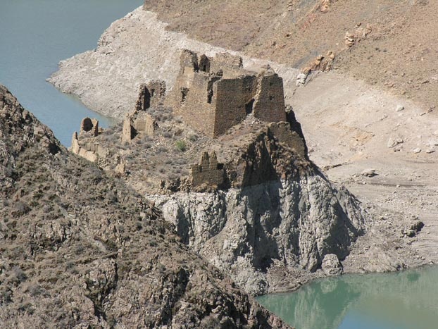 Our second day in a row of a very long drive was interesting and scenic.
The route from Shigatse south-southeast to Gyantse was a repeat. Then
the road ascended to Tibet's largest dam and long Y-shaped reservoir.
Most of the route, until we crossed the Yarlung-Tsangpo was, as usual,
sandstone and shale, green valleys and barren hillsides, giant alluvial
fans - all the sediment headed for the Bay of Bengal.
Our second day in a row of a very long drive was interesting and scenic.
The route from Shigatse south-southeast to Gyantse was a repeat. Then
the road ascended to Tibet's largest dam and long Y-shaped reservoir.
Most of the route, until we crossed the Yarlung-Tsangpo was, as usual,
sandstone and shale, green valleys and barren hillsides, giant alluvial
fans - all the sediment headed for the Bay of Bengal. 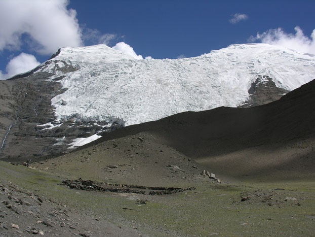 From the reservoir
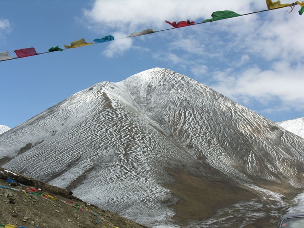
the road climbed to Karo La, another almost 5000-m pass. We watched
one of Tibet's most beautiful and famous mountains, Najin Kangtsang
(over 23,000 feet) the whole way. The peak is clothed with icefalls;
at the pass we were almost under the glaciers.
From the reservoir
the road climbed to Karo La, another almost 5000-m pass. We watched
one of Tibet's most beautiful and famous mountains, Najin Kangtsang
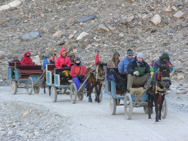
(over 23,000 feet) the whole way. The peak is clothed with icefalls;
at the pass we were almost under the glaciers. Descending eastward from the pass, we soon saw Yamdrok-Tso, one of Tibet's four holy lakes. From this huge and complexly shaped lake, pipes go north and down to the Yarlung Tsangpo for power generation. We had a lot of delays because of road construction by the Chinese army, but enjoyed driving along the lake and seeing three of the rare black-necked cranes. At the pass between the turquoise lake and the Yarlung-Tsangpo, we took pictures of each other riding yaks. After the bridge over the Yarlung Tsangpo, we took our earlier route to Lhasa and the nicest hotel yet. 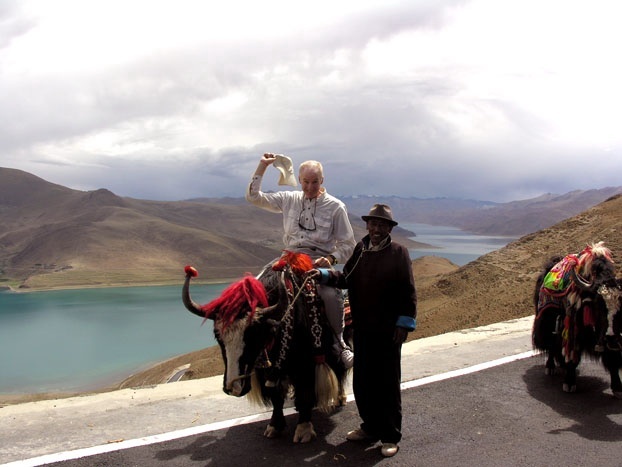 Tonight
the students returned to the bar of about a week ago. Again, when the
band took a break, four students (Egan on drums, Tyler vocal, Taylor
and a Tibetan on guitars, and in part, Miles and Taylor vocal) borrowed
the instruments, microphones, and sound system. Again, the clientele
went wild. The difference was that this time a TV crew had advance notice.
So Whitman rocked Lhasa tonight - at the New Light Coffee and Bar. The
Tonight
the students returned to the bar of about a week ago. Again, when the
band took a break, four students (Egan on drums, Tyler vocal, Taylor
and a Tibetan on guitars, and in part, Miles and Taylor vocal) borrowed
the instruments, microphones, and sound system. Again, the clientele
went wild. The difference was that this time a TV crew had advance notice.
So Whitman rocked Lhasa tonight - at the New Light Coffee and Bar. The
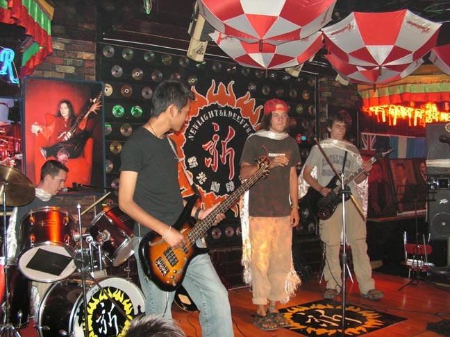 students played/sang five songs: Song 2, Lhasa Girl Jam, Punk Rock
Jam, Loving on the Roof of the World, Should I Stay or Should I
Go?.
students played/sang five songs: Song 2, Lhasa Girl Jam, Punk Rock
Jam, Loving on the Roof of the World, Should I Stay or Should I
Go?. June 15: Lhasa - Tsetang
For the third time we traveled the highway southwest from Lhasa to the
Yarlung-Tsangpo. We have said goodbye to our six 4WD Land Cruiser drivers,
and
 are in a bus, fortunately with air conditioning for this hot day.
All along the Yarlung Tsangpo are spectacular climbing dunes. The flood
plain has some dunes, but most impressive are the millions of mostly
poplar and/or cottonwood trees that have been planted as likely the
Earth's greatest afforestation project. We saw Samye Monastery across
the river.
are in a bus, fortunately with air conditioning for this hot day.
All along the Yarlung Tsangpo are spectacular climbing dunes. The flood
plain has some dunes, but most impressive are the millions of mostly
poplar and/or cottonwood trees that have been planted as likely the
Earth's greatest afforestation project. We saw Samye Monastery across
the river. Tsetang, Tibets third largest city, is downriver from Shigatse and Lhasa. The city is modern and clean, and the hotel is fancy. After lunch the group went to two places a few kilometers south of Tsetang. This is near where five US Army Air Corps men survived a plane crash during World War II. One place was the seventh-century Trandruk Monastery, one of the oldest is Tibet. The other place was Yumbulagang, supposedly the oldest building in Tibet; it dates to when Tibet had kings, before Buddhism and the Dalai Lamas. Gango Ri (4130m) rises 600 m above Tsetang and our hotel; the mountain is the legendary birthplace of Tibetans.
June
16: Tsethang - Samye
 Today the group traveled by bus down the south side of the Yarlung Tsangpo,
crossed a bridge, and went farther up the Yarlung Tsangpo on its north
bank - to Samye Monastery. First they climbed Hepo Ri, a hill east of
the monastery, to look down on the monastery and adjacent village. They
are built on the floodplain of the Samye, valley a tributary to the Yarlung
Tsangpo, and are surrounded by trees. After lunch, they toured the monastery,
Tibet's oldest, having been founded between 765 and 780AD. Shaped like
a
Today the group traveled by bus down the south side of the Yarlung Tsangpo,
crossed a bridge, and went farther up the Yarlung Tsangpo on its north
bank - to Samye Monastery. First they climbed Hepo Ri, a hill east of
the monastery, to look down on the monastery and adjacent village. They
are built on the floodplain of the Samye, valley a tributary to the Yarlung
Tsangpo, and are surrounded by trees. After lunch, they toured the monastery,
Tibet's oldest, having been founded between 765 and 780AD. Shaped like
a 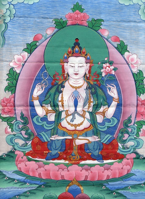 mandala, it has been damaged and destroyed many times in 1200+ years.
After dinner I gave a short thank you to the guides and students. Taylor (guitar) and Miles sang a funny song they composed about Tibet and geology. Tyler played guitar and sang his song about the future of a Tibetan boy. Palden gave to Bob and Clare a small painting of the Buddha of Compassion, and to Whitman College a large wall hanging of the same Buddha. Later the students were singing and talking in the garden. They were joined by English-speaking: Consul General from Saudi Arabia to ChinaThey had long political discussions as the UAR Consul General bought beer for all.
June
17: Leaving the Roof of the World (Lhasa - Bangkok)
 Today we leave Tibet; we go from high and dry to low and moist. We arose
early, and drove west along the south shore of the Yarlung Tsangpo.
I never tire of seeing the spectacular climbing dunes. At the airport
we had to say goodbye to our three dear guides, with hugs and some tears.
Today we leave Tibet; we go from high and dry to low and moist. We arose
early, and drove west along the south shore of the Yarlung Tsangpo.
I never tire of seeing the spectacular climbing dunes. At the airport
we had to say goodbye to our three dear guides, with hugs and some tears.
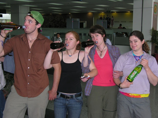
Security confiscated Taylor's Swiss Army knife, then used it to open the Lhasa beers the students had. The students had to return 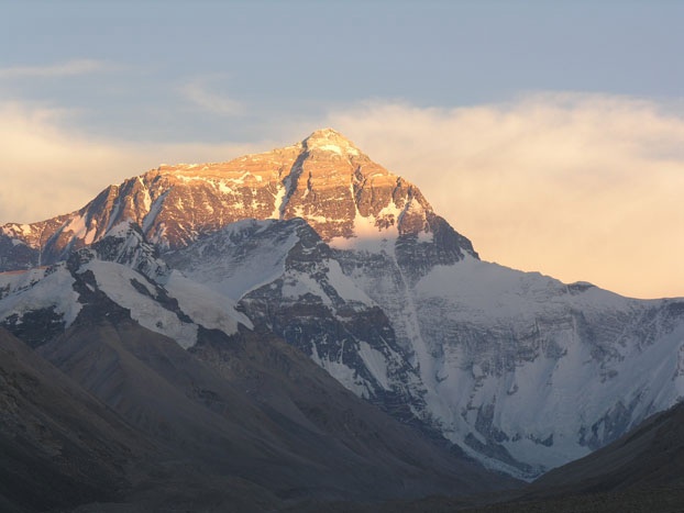 the beer bottles, full or empty, before they could have their boarding passes.
So, of course, the students drank the beers.
the beer bottles, full or empty, before they could have their boarding passes.
So, of course, the students drank the beers. The flight to Chengdu in western China departed about 11am. Clouds prevented our viewing the Himalayas we have come to love. |