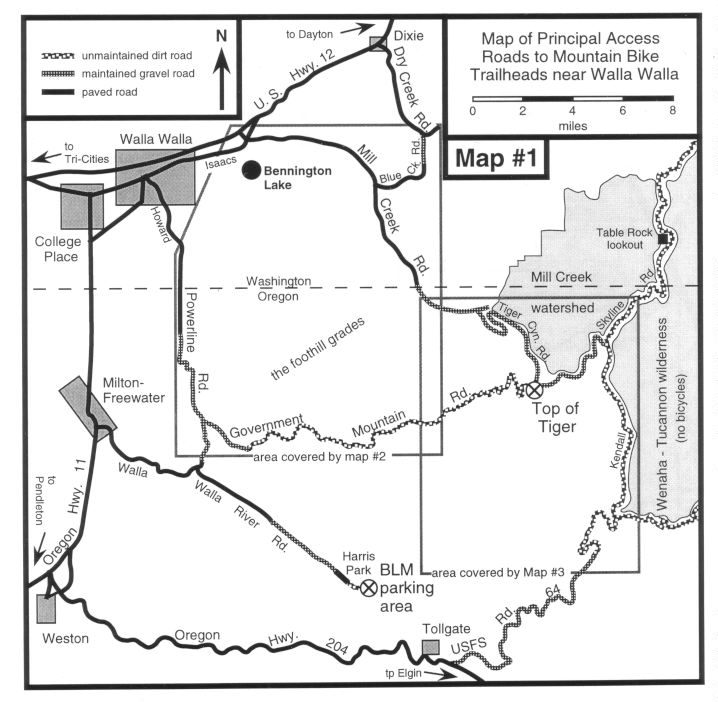
map showing how to get there
The canyon of the South Fork of the Walla Walla River is the most popular mountain bike destination in the Walla Walla area. Most riders start from a parking area maintained by the Bureau of Land Management (BLM) at the end of the gravel road upstream from Harris County Park. To get to this parking area, drive to Milton-Freewater and look for signs to "Upper Walla Walla River" and "Harris County Park - 13 miles" along Oregon Highway 11 on the south edge of town. At the signs, turn east onto the Walla Walla River Road. Follow the road to Harris Park (camping and picnic areas) and continue upstream past the park on a bumpy dirt road for another 0.5 mile to the BLM parking lot (restrooms).
If you are driving directly from Walla Walla, there is a shorter and more scenic route. From Cordiner Hall on the Whitman College campus, head south on Park Street to Howard Street. Continue south for 1.6 miles on Howard Street which then turns into Cottonwood Road at a 4-way stop. Continue on Cottonwood for 0.8 mile to another 4-way stop. Go straight ahead onto Powerline Road. After 3.4 miles, Powerline Road turns to gravel. After 5.7 miles of gravel, the road turns to pavement where you cross the North Fork of the Walla Walla River. Turn left after 0.1 mile and proceed up the valley of the South Fork. From this point it is 7.2 miles to Harris Park and another 0.5 mile to the BLM parking lot.
When parking at the BLM lot, make sure that you lock your car and secure any valuable items. There have been numerous reports of thefts from vehicles in this lot over the past several years.