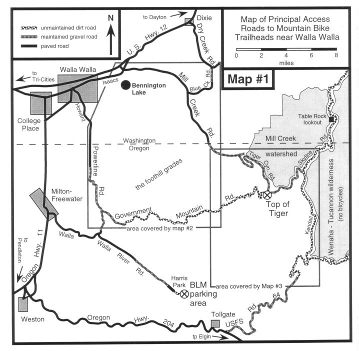
map showing how to get there
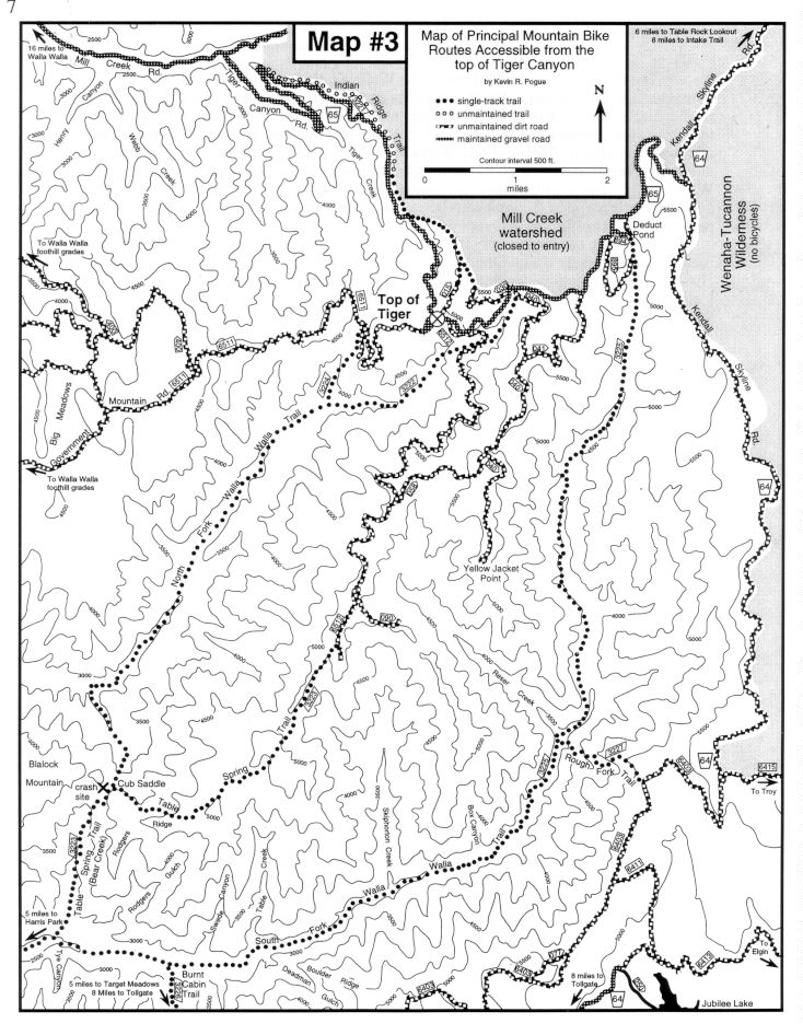
The best access to the crest of the Blue Mountains near Walla Walla is via US Forest Service (USFS) Road 65 (Tiger Canyon Road) which ascends the southwest flank of Indian Ridge above Tiger Creek. This road climbs 2450 ft. in 7.5 miles (avg. grade = 6.3%) to the watershed divide between Tiger Creek and and the North Fork of the Walla Walla River. At this ridge crest there is a Forest Service parking area near where Government Mountain Road intersects from the west and USFS Road 6512 intersects from the south. This point is hereafter referred to as the "Top of Tiger." USFS Road 65 continues beyond the Top of Tiger, climbing another 1120 ft. in the 5.3 miles to the intersection with the Kendall Skyline Road (USFS Road 64). See map #3 for an overview of mountain bike routes that are accessible from the Top of Tiger.
To reach Tiger Canyon Road from Walla Walla, take Isaacs Avenue eastbound to Mill Creek Road. Turn right onto Mill Creek Road and drive 13.5 miles (last 2.5 miles are gravel) until you see a "dead end" sign. Tiger Canyon Road is the right turn just before the dead end sign. Some riders may want the extra exercise involved with an ascent of Tiger Canyon Road. If so, park near the bridge over Mill Creek and begin your ride there. To reach the top of Tiger Canyon, drive another 7.5 miles. Tiger Canyon Road is closed by a gate one mile above Mill Creek between December 1 and April 15. You may still ride on the road but you will not be able to drive to the top of Tiger Canyon between these dates.
To reach Tiger Canyon Road from outside of Walla Walla, exit south from US Hwy. 12 at the "Rooks Park" exit on the east side of town. At the stop sign, proceed straight across Isaacs Avenue onto Mill Creek Road. Stay on Mill Creek Road for 13.5 miles to where Tiger Canyon Road enters on the right just before the "dead end" sign.